The City Plan 2016 guides land use and traffic planning in Helsinki. Helsinki will be developed as a rail network city, and the inner city will be expanded. Significant new land use is planned in the surroundings of motorway areas, station areas, rail traffic hubs and the existing and future major rail traffic stops. Up to 45 per cent of new residential buildings will be complementary construction in existing residential areas.
The local master plans supplement the city plan. They will be prepared for the Länsiväylä and Viikinranta-Lahdenväylä areas and for Östersundom and Vartiosaari.
A local master plan identifies the area’s key community structure and focuses on issues that are essential to the urban structure, such as housing, the location of workplaces and services, transport connections, and the recreational and green network. It steers the future detailed planning of the area in question.
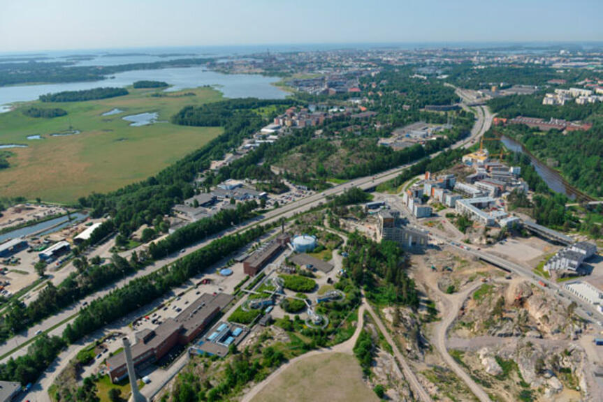
Inner city expands towards Länsiväylä
The Supreme Administrative Court repealed some of the City Plan 2016 markings along the Länsiväylä, including the City boulevard marking. However, the plan allows for urban construction on both sides of the repealed strip in Lauttasaari. The local master planning applies to Länsiväylä and its surrounding areas in Koivusaari, Lauttasaari and Salmisaari. The local master plan will be prepared in 2022–2025.
The planning work aims to reduce the adverse effects of the fairway-type traffic environment on the population and to explore the possibilities of developing the urban structure along Länsiväylä in Lauttasaari and Salmisaari. The objectives include, for example, determining the area’s land use and traffic as a whole, expanding the inner city, enabling diverse housing production under the AM Housing and Land Use Programme, diversifying the service structure of the area, providing good locations for business activities and workplaces and creating the preconditions for a high-quality and attractive urban space.
The preparation of the plan shall consider the impact of the plan on the residents’ living conditions, habitat, cityscape, nature, recreation, landscape, cultural heritage and transport. The impact of the new urban structure and any land reclamation on climate and adaptation to climate change will also be considered. The harbour tunnel to be built from the West Harbour to Länsiväylä affects the land use planning in Salmisaari.
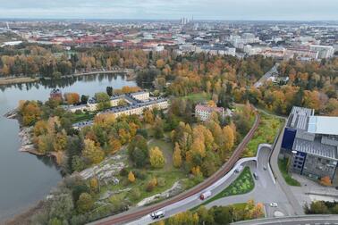
Viikinranta−Lahdenväylä plan connects Arabianranta to Viikki
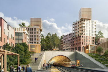
Public transport will be based on the Viikki-Malmi light rail line, or Viima. The local master plan ensures the implementation conditions and smooth traffic for Viima and enables new construction in its influence area. The Viima light rail line is estimated to be completed in the 2030s. The functionality of Lahdenväylä, which is important for national public transport and freight traffic, will be ensured.
The Natura site in Vanhankaupunginlahti is an important starting point for the planning, the natural values of which will be safeguarded despite increased land use and attrition. The green network is one of the attraction factors in the area.
Rail link and green network key issues at Östersundom
The joint master plan for Östersundom by Helsinki, Vantaa and Sipoo was repealed in May 2021, and planning in the area continues with local master planning. The planning area of Östersundom’s partial master plan includes the entire Östersundom greater district and part of the Mustavuori subarea.
The local master plan aims to prepare for the population growth in Helsinki, to steer the growth in a sustainable manner, to increase the supply of diverse housing types, to provide construction sites for detached houses and to balance the regional structure of the Helsinki Metropolitan Area towards the east.
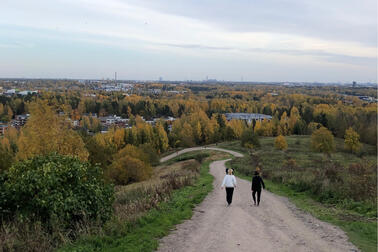
The key issues to be resolved in the Östersundom local master plan are the rail link, the land use supporting it and the strengthening of the green network. The protection of the Natura 2000 sites, nature reserves and important ecological links in the area are important starting points for the planning.
There is also small-scale detailed planning ongoing in Östersundom for Landbo and the northern part of Karhusaari and a detached housing planning programme to allow complementary construction in the existing detached house areas in Östersundom.
Vartiosaari designated for recreational use
In accordance with the Helsinki City Strategy 2021−2025, Vartiosaari is designated for recreational use.
The island is developed into an active recreational area as a part of the East Helsinki Culture Park. The aim is to plan the recreational activities in line with the nature values in the area. The island as a whole is part of the maritime East Helsinki Culture Park, and the forests are part of the Helsinki forest network.
The protection of the villa area, which is of national value, will be promoted. The development of recreational, holiday and tourism services in Vartiosaari will be facilitated. The plan will ensure the accessibility of services on the island and consider the existing recreational routes. The aim is to protect the nature sites.
Residents and stakeholders consulted during the planning
The progress of the local master plans and opportunities for participation will be communicated throughout the planning process. The most important participation procedures include the statutory deposit stage, negotiations between authorities and stakeholders, presentation and discussion events and informal discussions with the planners. More detailed information on the participation opportunities and planning schedules is available on the Helsinki New Horizons website.


